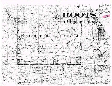
1861

| Date | Title | Summary | |
|---|---|---|---|
1861 |
A Glenview Survey | |
|
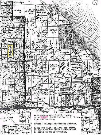
| 1861 | Real estate map Cook County | |
"Real estate map of Cook County." |
| 1898 | Map of Northfield | |
Map of Northfield, 1898, includes property owner names |
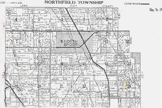
| 1921 | Map of Northfield Township | |
Map of Northfield Township, 1921 |
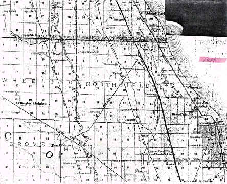
| 1926 | Map of Northfield | |
Map of Northfield Township, 1926, showing paved roads |
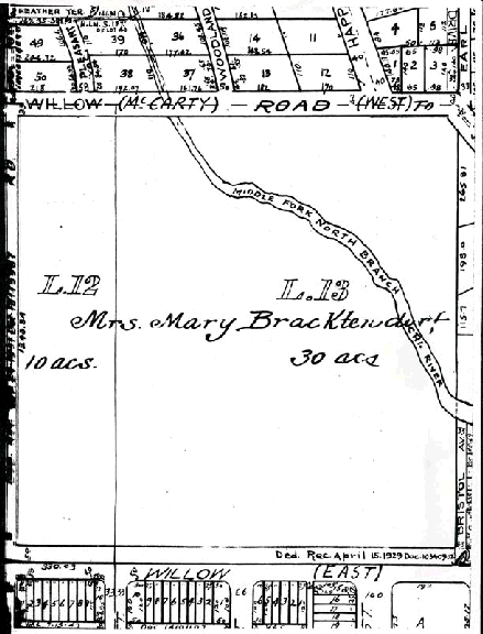
| 1929 | Brachtendorf land | |
Original plat survey of Brachtendorf land c. 1929 |
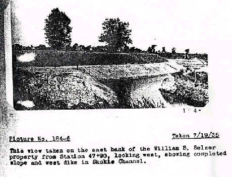
| 1935 | Skokie Lagoons | |
Picture of Selzer from Statioin 47 and 90 looking west |
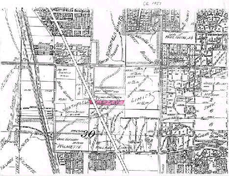
| 1937 | Map of Northfield Village | |
Map of Northfield Village c. 1937 |
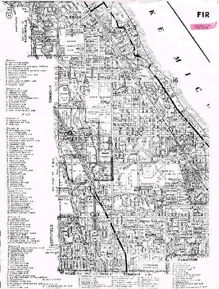
| 1965 | Map of Northfield | |
Map of Northfield, 1965 |
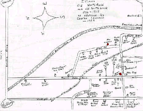
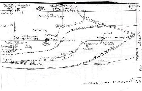
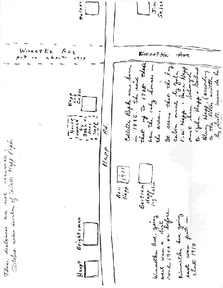
| 1982 | Charles Levernier hand-drawn maps | |
Series of hand-drawn maps of Northfield 1910-1915, drawn by Charles Levernier in 1982 |
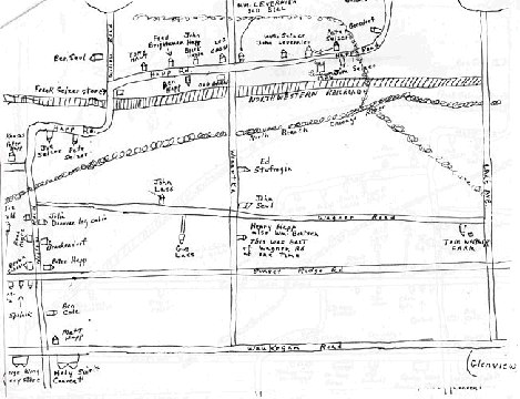
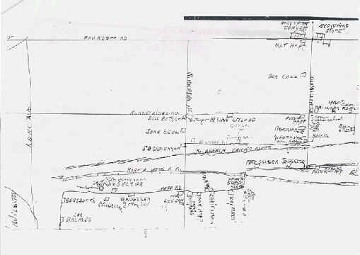
| 1982 | Charles Levernier hand-drawn maps | |
Series of hand-drawn maps of Northfield 1910-1915, drawn by Charles Levernier in 1982 |
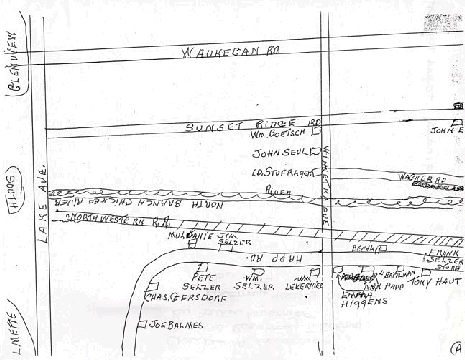
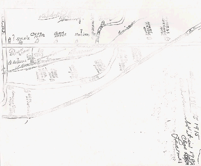
| 1982 | Charles Levernier hand-drawn maps | |
Series of hand-drawn maps of Northfield 1910-1915, drawn by Charles Levernier in 1982 |
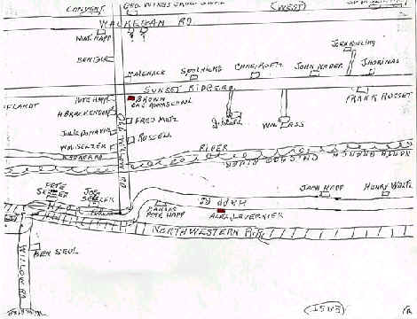
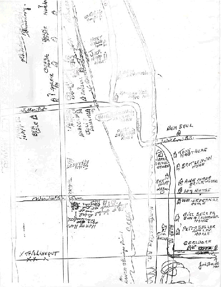
| 1982 | Charles Levernier hand-drawn maps | |
Series of hand-drawn maps of Northfield 1910-1915, drawn by Charles Levernier in 1982 |
| 1982 | Charles Levernier hand-drawn maps | |
Series of hand-drawn maps of Northfield 1910-1915, drawn by Charles Levernier in 1982 |
| 1982 | Charles Levernier hand-drawn maps | |
Series of hand-drawn maps of Northfield 1910-1915, drawn by Charles Levernier in 1982 |
| 1982 | Charles Levernier hand-drawn maps | |
Series of hand-drawn maps of Northfield 1910-1915, drawn by Charles Levernier in 1982 |
| 1982 | Charles Levernier hand-drawn maps | |
Series of hand-drawn maps of Northfield 1910-1915, drawn by Charles Levernier in 1982 |
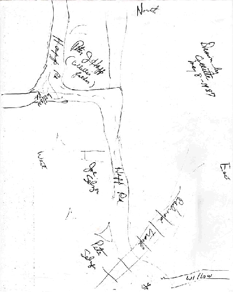
| 1987 | Collette Happ Lepke, hand-drawn maps | |
2 maps (hand-drawn) of Northfield c. 1905. Drawn by Collette Happ Lepke in 1987 |
| 1987 | Collette Happ Lepke, hand-drawn maps | |
2 maps (hand-drawn) of Northfield c. 1905. Drawn by Collette Happ Lepke in 1987 |